


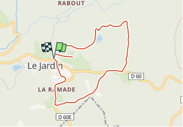

6,9 km | 8,7 km-effort


Tous les sentiers balisés d’Europe GUIDE+


Kostenlosegpshiking-Anwendung
 SityTrail
IGN / Geografische Institute
SityTrail World
Die Welt öffnet sich für Sie
Tour Zu Fuß von 4,4 km verfügbar auf Neu-Aquitanien, Corrèze, Le Jardin. Diese Tour wird von SityTrail - itinéraires balisés pédestres vorgeschlagen.
Website: https://rando-millevaches.fr/pedestre/le-jardin-bourg/

Wandern
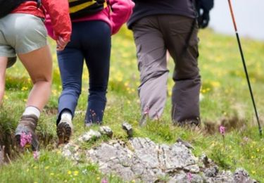
Wandern
Zu Fuß

Wandern

Pferd

Mountainbike

Wandern

Mountainbike
Pferd